Girujan Fm
Type Locality and Naming
Middle formation of the Tipam Gr (or upper formation if Namsang Fm is assigned to a Moran Gr). The name Girujan Clay Stage was given by P Evans after a small stream at Digboi (27°23'N; 95°38'E) in Assam. [Original Publication: Evans, P. (1932) Tertiary succession in Assam, Trans. Min. Geol. Insti, India, Vol. 27, pp: 173-200.]. Reference well: Well Charaideo-1, depth 1840 - 2970 m.
Synonyms: Girujan Clay Fm. Redesignated by Bhandari et al (1973); A thick clay sequence conformably overlying Tipam Sandstone Stage (Jaipur Fm) was designated as Girujan Clay Stage (Evans, 1932). Later Bhandari et al., (1973) considered this unit to be of formation rank. The Gobindpur Formation of Deshpande et al., 1993, named after well Gobindpur-1 has a physical continuity with Girujan Formation and accordingly included in this unit.
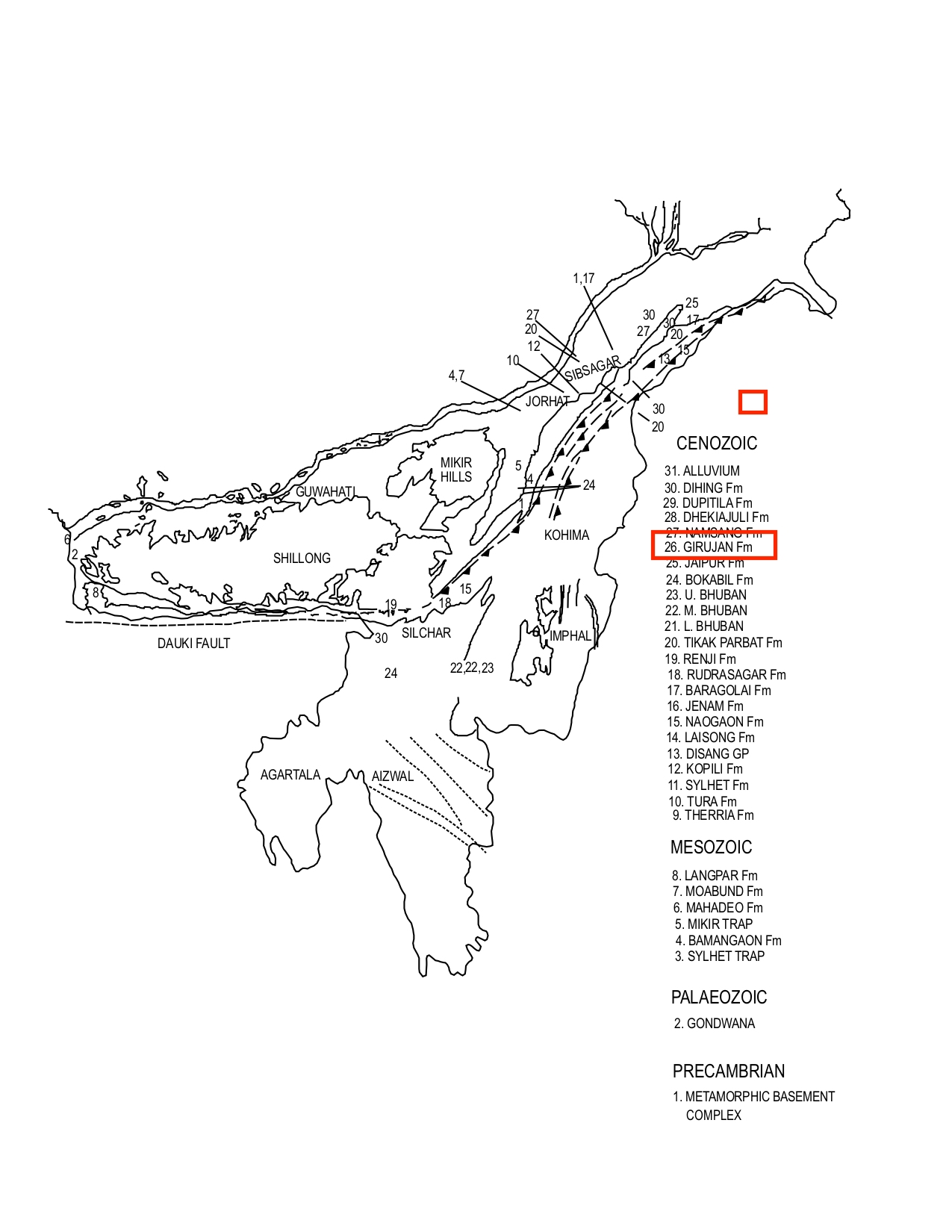
[Figure 1: Geological set up and formation stratotypes of North East Basins (modified after Pandey and Dave, 1998)]
Lithology and Thickness
Claystone. The Girujan Fm comprises mainly variegated and mottled clays, commonly red brown or orange grey to buff colored clays. These are soft and sticky when wet, the sandstones are soft to moderately hard, fine to medium grained, well to ill sorted, thinly bedded. The siltstones are hard occasionally calcareous. Rare coals or calcareous clays are also present. In SE Bangladesh, it is composed mainly of mottled clay with subordinate mottled sandy clay, and of sandstone with subordinate ferruginous sandstone. Fossil wood and lignite are also present in the unit.
In the designated reference section the thickness is 1130 m. The thickness increases towards NE. It is reported to be more than 2500 m in the Kharsang oil field. The thickness drastically reduces to the north and southeast and within a distance of 30 km the thickness reduces to 10-15 m in Rudrasagar-Disangmukh and 20 m in Jhanji to 10 m in Teok. In the exposed part the thickness varies from less than 200 m to more than 2000 m. In the Schuppen Belt the true thickness of the Girujan is difficult to estimate, as the upper contact is thrusted.
Relationships and Distribution
Lower contact
The formation develops conformably and gradationally from the underlying Tipam Sandstone (now called the Jaipur Fm).
Upper contact
The formation is unconformably overlain by Namsang Fm Sandstone, or by the sandstones of the Dupitila Fm (depending upon regional usage).
Regional extent
Mikir Hills, Dhansiri Valley, Upper Assam Shelf, Naga Schuppen Belt, SE Bangladesh: The overall lithological characteristics of Girujan Formation persist over a wide area in Upper Assam. In the Schuppen Belt the percentage of sand increases towards southwest, and beyond Zubza river it passes laterally into Jaipur Fm. In SE Bangladesh, the deposits are preserved mainly in the large valleys coinciding with major synclinal trends of the fold belt.
GeoJSON
Fossils
It is poorly fossiliferous. The palynoflora include Circulisporites sp., Scabratriletes sp., pollens of Graminae, Compositae, Umbelliferra sp and fresh-water algal bodies.
Age
Depositional setting
Additional Information
Banglapedia (National Encyclopedia of Bangladesh as compiled by several geologists; http://en.banglapedia.org/index.php/Geological_Group-Formation; 2015)
